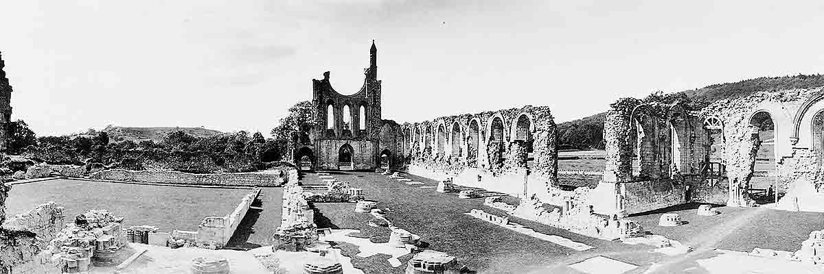
Research on Byland Abbey
Byland Abbey has been studied, mapped and drawn by antiquarians, artists, historians and archaeologists for over 350 years. Until recently most of the focus was on the historical record and on the architectural style and dating of the buildings. More recent research has given more attention to the site’s archaeology.

Documentary Research
Byland Abbey offers much scope for further research, starting with the cartulary, or institutional records kept by the monastery, which has recently been published.[1] This offers the opportunity to chart and clarify the exact landholdings of the abbey on the ground. This has distinct ramifications when trying to assess the economy of the estates and the changing agricultural practices of the period.
Precinct
Parts of the Byland precinct were surveyed in the 1960s, revealing extensive earthwork remains.[2]
The survey of the precinct is incomplete, however, and there is scope for more work to understand the various earthwork remains, clarify the extent of the precinct wall and identify the precinct buildings. There are thought to have been mills and a tannery on the site; these have yet to be positively identified and their workings understood.
Survey work by English Heritage has revealed much new evidence about the northern half of the precinct. The buildings of the outer court were concentrated to the west of the main claustral ranges. Small scale excavations within the site of the outer court have confirmed the presence of what is likely to have been the guest hall and other service buildings. Yet much remains unknown, and there is great potential for further investigation.[3]
Infirmary
The apparent absence of an infirmary hall east of the main claustral complex raises questions about its location and plan.
When the site was cleared in the 1920s, it was thought that the buildings to the south-east represented the infirmary complex, but this seems unlikely. The 12th-century part of the range may have been an adjunct to the main infirmary, but the developed layout of the range suggests a later use as the abbot’s chambers. Geophysical exploration of the area might elucidate the situation and locate the apparently missing infirmary complex.
Lay Brothers’ Accommodation
It is likely that the lay brothers had a separate infirmary hall and kitchen. The most probable location is to the south-west of the western range, where there are indications on the ground of ruined structures. These may form an additional example of redundant buildings being demolished before Byland’s suppression. A combination of earthwork and geophysical survey might clarify this point.
Abbey Church
The church was initially laid out with a lower floor at the west end than is now the case. Evidence for a minor doorway in the south nave aisle and at the end of the lane raises the possibility of there being a temporary church located beneath the present nave. Archaeological investigation in this area might resolve this question.
Stonework
A basic survey in the 1980s of the dispersal of stone from the abbey in the immediate locality showed that considerable quantities can be identified.[4] Since that survey, more abbey stone has been identified and there can be little doubt that a fresh survey would reveal more. The survival of detached architectural fragments adds considerably to our understanding of the abbey buildings, particularly the church.
The Office of Works removed thousands of tons of debris from the claustral ranges and church, and much was tipped and spread to the south and possibly the north of the site. A survey of the precinct might resolve the extent of this tipping and define its area.
Considerable quantities of stone were also buried. Photographs of the excavations show large quantities of carved stone, including major capitals and vault keystones from the church, few of which can now be traced. Local oral tradition suggests that much stone was buried in the field south of the site. Location of this material might add considerably to our understanding of the fabric of the buildings.
Water Management
Survey work by English Heritage has clarified and modified the interpretation of the water management system, which has been altered since the suppression of the abbey.[5]
To drain the site, the monks engineered the landscape and diverted streams to flush drains built beneath the abbey buildings. The main precinct was also walled and enclosed, an area of about 110 acres. A series of small dams along the Oldstead road appear to have been built as storm water storage areas to stop the abbey being flooded.
Our understanding of how the flood defence dams worked is vague, however, and could be further enhanced with more study of the hydrology of the precinct. The source of the water supply and the course of the main feeder pipes through the precinct is also currently not known.
READ MORE ABOUT BYLAND ABBEY
Footnotes
1. J Burton (ed), The Cartulary of Byland Abbey (Surtees Society, 2004)
2. J McDonnell and R Everest, ‘The waterworks of Byland Abbey’, Ryedale Historian, 1 (1965), 32–9; J McDonnell and SA Harrison, ‘Monastic earthworks south of Byland Abbey’, Ryedale Historian, 9 (1978), 5.
3. M Jecock, A Burn, G Brown and A Oswald, Byland Abbey, Ryedale, North Yorkshire: Archaeological Survey and Investigation of part of the Precinct and Extra-Mural Area, English Heritage Research Department Report 4/2011 (Swindon, 2011).
4. S Harrison, ‘The stonework of Byland Abbey’, Ryedale Historian, 13 (1986), 26–47.
5. Jecock et al, op cit.