Upper Plym Valley

Audio Guide to Upper Plym Valley

Join Win Scutt, English Heritage Properties Curator, in conversation with Helen Allen, Free Sites Partnership Manager, at the Upper Plym Valley. Together they explore some key locations around the site, and Win explains what we know about the site and what life might have been like here in the late Neolithic period and Bronze Age.

The guide is designed so you can listen whether you are at the site or elsewhere. For on-site listening, it’s advisable to download before you go, as mobile signal at the Upper Plym Valley is variable. You will also find a link below to download a map, which will help you both to plan ahead and to find your way around during your visit.


Image gallery

Scroll through these images to view the key locations explored in the audio guide.

River Plym

River Plym

River Plym
The river Plym near Trowlesworthy car park. The cluster of trees on the horizon marks Trowlesworthy Warren House
Bronze Age roundhouse

Bronze Age roundhouse

Bronze Age roundhouse
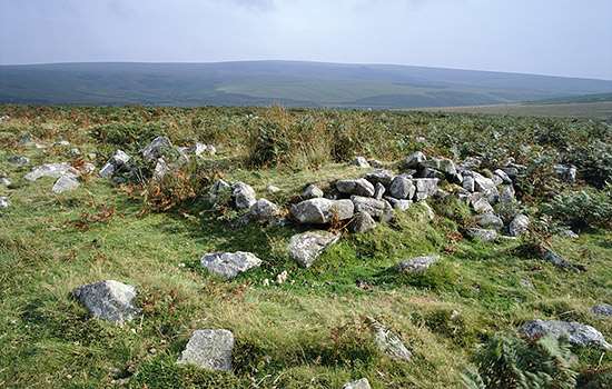
This circle of large stones marks the position of a prehistoric roundhouse near the track leading up to Trowlesworthy Warren House
Pillow mound

Pillow mound

Pillow mound
A low, rectangular earthen mound, known as a pillow mound, at Trowlesworthy Warren
Group of roundhouses

Group of roundhouses

Group of roundhouses
One of the groups of roundhouses at Trowlesworthy, where half a dozen houses are enclosed within a circular bank
Stone circle

Stone circle

Stone circle
This small stone circle of eight stones sits at the northern end of a double stone row

Before you go