Key Facts about Corbridge Roman Town
- From its beginnings as a military fort, Corbridge evolved into a vibrant civilian settlement – the most northerly town in the Roman Empire. Unlike other settlements in the area, it continued to flourish even in the later stages of Roman rule in Britannia.
- Roman Corbridge was set at the junction of two major roads: Dere Street, running north to south, and the Stanegate, running east to west. The nearby river Tyne provided another major route for trade and travel.
- The history of Roman Corbridge is entwined with that of Hadrian’s Wall, just 2.5 miles to the north. Soldiers passed through to serve on the Wall, while the traders working in the town’s bustling high street provided the Wall with vital supplies.
- The town’s original name, Coria, means ‘hosting place’ in Celtic, indicating its function as a central meeting place at the north-western frontier of the Roman Empire.
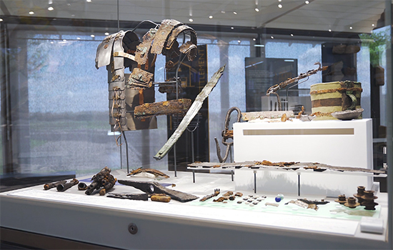
- In 1964 archaeologists unearthed a wooden chest buried by a Roman soldier some 1,800 years earlier. Now known as the Corbridge Hoard, some objects from this fascinating time capsule can be seen in the museum.
Discover Corbridge
-
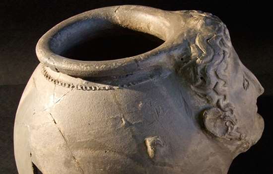
The Mysteries of Corbridge
From strange heads on pots to missing temples, there are many things about Corbridge that continue to puzzle us. Read about the site’s most enigmatic mysteries here.
-
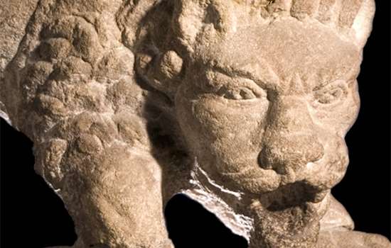
The Corbridge Lion and Changing Beliefs
Lions were commonly used as sacred symbols in Roman memorials, but the Corbridge lion is different. Discover what this extraordinary sculpture tells us about changing beliefs in Roman Britain.
-

Collection Highlights
Enjoy a gallery of edited highlights from Corbridge’s immense collection, and then explore more objects in 3D, below.
Explore the Collection in 3D
Scroll through the images below to view the highlights of Corbridge’s museum collection in 3D. Click the play button and use your cursor or touch screen to rotate the object and zoom in. For descriptions of each object, click the title in the top left of the screen (opens in new window).
Models derived photogrammetrically by Jon Bedford of the Geospatial Imaging Team at Historic England on behalf of English Heritage.
More About Corbridge
-

Description of Corbridge Roman Town
Read about the surviving buildings of Corbridge – including the granaries with their intact ventilation system – and imagine how the town would have looked in its heyday.
-

Sources for researchers
See our list of key visual and written sources for the study of Corbridge Roman Town.
-

Research on Corbridge Roman Town
Discover what we’ve learned from excavations at Corbridge Roman Town, and what we’re still trying to understand.
-

What makes Corbridge so significant?
Learn how the extensive excavations at Corbridge have made it one of the most important sites for research in the Hadrian’s Wall region.
-

Site plan of Roman Corbridge
Download a PDF showing an aerial plan of the visible remains at Cobridge Roman Town.
-
Buy the Guidebook
This guidebook gives a full tour of the site and museum as well as a detailed history of Roman Corbridge.
More about Hadrian’s Wall
-
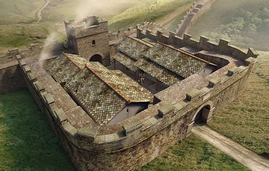
Hadrian’s Wall: History and Stories
Discover the histories, stories and mysteries associated with English Heritage’s Hadrian’s Wall sites.
-

Birdoswald: History and Stories
Explore Birdoswald through time and learn about the community who travelled across the Empire and made the fort their home.
-

History of Housesteads Roman Fort
Read about the fascinating history of Housesteads – the most complete example of a Roman fort in Britain, and one of the best known from the entire Roman Empire.
-
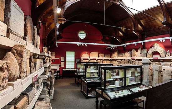
History of Chesters Roman Fort and Museum
Learn about the history of Chester’s Roman Fort and the rich collection in its traditional Victorian museum.

