History of Reculver Towers and Roman Fort
The Roman fort at Reculver dates from the early 3rd century AD, when it was built to guard the northern end of the Wantsum Channel (now silted up) that divided the Isle of Thanet from the mainland. Substantial remains of the fort walls survive, although about half the site has been lost due to coastal erosion.
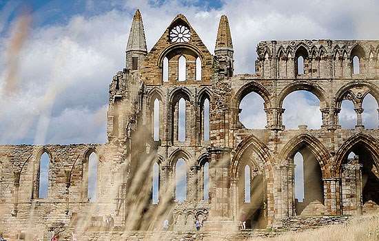
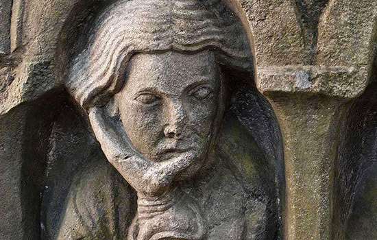
Within the fort a Saxon monastery was established in the mid 7th century, and today the most dominant features of the site are the 12th-century towers of the former monastic church. Standing out on the skyline for miles around, they act as a navigation marker for shipping.
Roman Reculver
Two thousand years ago the geography of this area was very different. The Wantsum, a sea channel up to 3 miles wide, cut off the Isle of Thanet from the mainland. Today the Wantsum has silted up and become dry land.
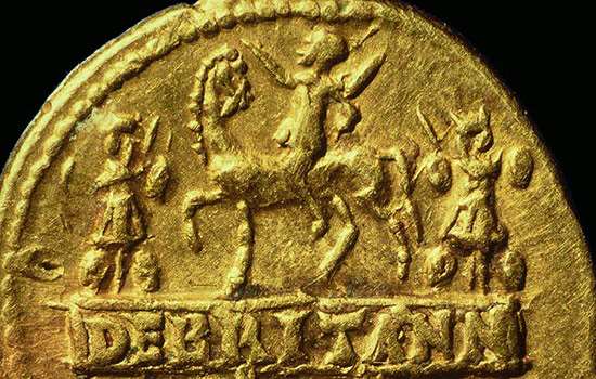
The Romans conquered Britain under the Emperor Claudius in AD 43. Under General Aulus Plautius, the Roman armies landed unopposed. There is some debate as to the location of the invasion, but a strong candidate is the Wantsum channel. Parts of fortifications of the Claudian period have been found both at Richborough and Reculver, located at opposite ends of the Wantsum. Both sites played a role in the earliest years of the conquest.
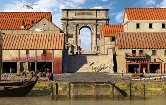
During the 1st and 2nd centuries a Roman settlement grew up at Reculver, probably around a harbour. The size of this settlement is unknown, as coastal erosion has destroyed much of the evidence.
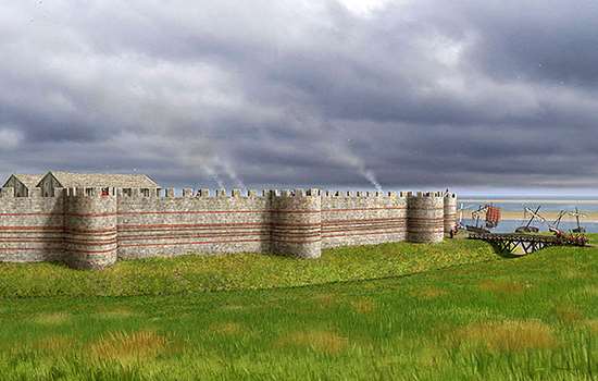
In the early 3rd century a fort was built. It stood on a promontory at the north end of the channel where it joined the Thames estuary. Nearly square, with rounded corners, it measured 180 metres by 175 metres (590 feet by 574 feet). Its flint walls were backed with earth ramparts and surrounded by two ditches 10 metres (33 feet) wide. This was one of the very earliest of the so-called forts of the Saxon Shore, and was traditional in its plan. Later Saxon Shore forts (including Richborough, Pevensey and Portchester) were built to a new model with projecting bastions.
Roman remains
The southern half of the Roman fort at Reculver survives as ruined walls and earthworks.
The core of the enclosing wall, which would originally have been topped with a wall walk and parapet, is mainly flint and in parts survives to a height of almost 3 metres (10 feet). It can be best appreciated by walking around the outer perimeter of the fort. It was originally faced with squared greensand blocks, but these have almost all disappeared.
There were originally four gateway entrances, one through the centre of each side of the defences. The south and east gates can still be seen. The east gate consisted of a single carriageway 2.7 metres (9 feet) wide contained within a masonry arch and with a single guard chamber to the north. Tiles in the walls enclosing the guard chamber may represent a later rebuilding. The south gate was of similar form.
The Kent Archaeological Rescue Unit undertook excavations at Reculver
between 1959 and 1969, revealing crucial details of the fort’s date, interior
layout and buildings, including barracks, a bath-house and the headquarters building. No traces of these buildings remain above ground.
A religious site
By the 5th century the Romans had abandoned their defence of Britain and the fort at Reculver had fallen into disuse.
An Anglo-Saxon monastery was founded on the site in 669, reusing the existing defences. The church of St Mary was built near the centre of the earlier fort. The earliest monastic church on the site survives in the form of buried foundations, which are marked out in modern concrete, and as standing ruins incorporated in the later parish church. The early walling incorporated reused Roman tiles, bricks and rubble masonry.
Documentary evidence suggests that the site had ceased to function as a monastic house by the 10th century, after which time the church became the parish church of Reculver. Remodelling of the church in the 12th century included the addition of tall twin towers.
In 1540 the sea was still a quarter of a mile away to the north, but rapid erosion meant that by 1781 the north-west corner of the Roman fort had fallen away. The eroded material was carried eastwards by the sea and contributed to the blocking and silting of the Wantsum Channel.
The church became unsafe, and in 1807 the vicar persuaded his parishioners to abandon it. It was partly demolished in 1809, leaving the towers as a sea-mark.
Some of the stone from the demolished church was used to build the new parish church inland on higher ground at Hillborough, but 2,000 tons of it were sold and incorporated into the construction of Margate Harbour, completed in 1815.
Reculver Towers Restored
Reculver’s location on the North Kent coast means that the site is especially vulnerable to the effects of climate change, including harsh weather conditions and coastal erosion.
Learn about the conservation works that took place at Reculver in 2023 to protect it for the future. Hear from the team of experts who worked on the site, including stonemasons, carpenters and leadwork specialists, and learn about some of the techniques they used and challenges they faced during the process.