Research on Wheeldale Roman Road
Research questions hinge around two key issues, the date of the monument and its function.

Previous Research and Current Theories
Since the first recording of the monument by John Warburton in 1720,[1] most commentators have assumed it to be part of a Roman road and focused on its possible route and purpose.
During the clearing of the site between 1912 and 1920, no pottery or coins were found to establish a possible date. Its identification as a Roman road therefore revolves around the form of the monument itself.
If the monument does represent the remains of a Roman road, it would not be unusual for elements of it to have been robbed away over the centuries or that it had required some maintenance. However, it has been reported that a one-time custodian at Wheeldale Moor did much ‘reconstruction’ of the culverts and that the kerbing as seen is also the product of his efforts.[2] This begs the question of how much of the visible structure, if any, can be assumed to be Roman.
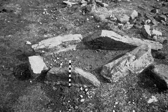
The discovery of two or three cist burials cut into the edge of the monument, which could be prehistoric or Roman in date, does not completely preclude its being a Roman road, but the existence of upright stones protruding through the surface by up to 0.4 metres suggests that it was unlikely to have been used for traffic.[3]
On the other hand, the presence of kerbs and the use of freestone gathered from the surrounding moorland, although not the provision of culverts, would be entirely appropriate if the monument represents a Neolithic or early Bronze Age boundary, as proposed by Blaise Vyner, who has noted that ‘it has none of the characteristics of a Roman road. It is restricted to Wheeldale Moor, and follows a sinuous course. It is also broken by watercourses.’[4]
Questions for Future Research
- The date of the monument might be addressed through excavation, which might recover material susceptible to scientific dating from sealed deposits.
- The monument’s function might be a more difficult question to address, although inconsistencies in its form, such as the upstanding stones, argue against it being a road. Given the level of recent ‘maintenance’ or ‘interference’ with the structure, though, even excavation might not provide conclusive answers.
- It is possible that documentation might exist that could shed light on any medieval use of the monument as a route, but unless it featured in a boundary dispute or something similar that required detailed topographic description of landmarks, it is highly unlikely that the monument would be clearly identified.
- Aerial survey, LIDAR (Light Detecting and Ranging) and other remote sensing techniques might help trace or confirm any extensions of the monument to the north or south and possibly identify currently unknown associated features.
READ MORE ABOUT WHEELDALE ROMAN ROAD
Footnotes
1. J Warburton, A New and Correct Map of the County of York in All its Divisions (London, 1720).
2. P Wilson, ‘To build or not to build? Presenting Roman sites in Britain’, in Schutzbauten und Rekonstruktionen in der Archäologie, ed M Müller, T Otten and U Wulf-Rheidt, Xantener Berichte 19 (Xanten, 2011), 265.
3. RH Hayes and JG Rutter, Wade’s Causeway: A Roman Road in North-East Yorkshire, Scarborough and District Archaeological Society Research Report 4 (Scarborough, 1964), 55–6.
4. Letters, British Archaeology, 29 (Nov 1997) [accessed 22 Aug 2012]; see also B Vyner, ‘Wade’s Causeway and the Wheeldale Moor linear monument: the end of the Roman road?’ (in prep).
